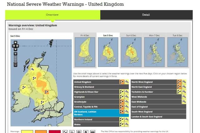
Weather warning: Storm Desmond coming to the Borders


The Met Office has issued an amber (Be Prepared) warning from 2am on Saturday until 6am on Sunday 6 December for heavy and persistent rain, with disruption to travel likely as well as flooding to properties and some communities in the Borders.
The warning follows on from flooding and high water levels last night across the Borders.
Advertisement
Hide AdAdvertisement
Hide AdAcross the Borders in Northumberland tonight a road is closed after high winds brought down a tree and power cables, leaving homes in the area without electricity.
The B6348 near Wooler closed in both directions between the B6349 junction and the Weetwood Avenue junction, because of a fallen tree and collapsed power cables.
There were also no trains between Berwick-upon-Tweed and Edinburgh tonight because of overhead wire damage.
A total of 60mm to 100mm of rainfall is predicted on already saturated ground in the Borders tomorrow, and 150mm to 200mm on higher areas. Winds of around 70mph are also anticipated.
Advertisement
Hide AdAdvertisement
Hide AdRain is expected to become persistent and heavy overnight and last through Saturday, before clearing southwards early on Sunday. A yellow warning for wind and rain is currently in place until 11.55pm today.
Given saturated conditions and high river levels from recent rainfall – further flooding is likely. This is likely to lead to difficult driving conditions.
Storm Desmond is the fourth storm to be named by The Met Office this winter, after storms Abigail, Barney and Clodagh.
In its latest warning, the Met Office said: “Be prepared for the likelihood of flooding affecting properties and parts of communities.
Advertisement
Hide AdAdvertisement
Hide Ad“Watercourses may become dangerous, deep and fast-flowing, while some transport disruption seems likely.”
Marc Becker, Sepa’s hydrology duty manager, said: “Rainfall will be heaviest over central and southern areas of Scotland during Friday evening and throughout Saturday which will cause river levels to rise.
“River levels in the Tay, Clyde and Tweed catchments are already high and are expected to rise considerably in the next 24 hours.
“Over the coming days we will continue to monitor levels and update the public on our latest forecasts via social media and Floodline.
Advertisement
Hide AdAdvertisement
Hide Ad“We would encourage members of the public to remain vigilant and be mindful of the conditions in their locality and when travelling.”
Members of the public are being advised to take extreme care when out and about over the weekend.
Communities in the western Borders are particularly vulnerable from rising river levels. Nearest sandbag stores can be found at all Borders fire stations as well as community groups which have signed up to Resilient Communities.
Scottish Borders Council’s emergency planning bunker has been opened and a multi-agency team, including the emergency services, is in place to co-ordinate the response.
Advertisement
Hide AdAdvertisement
Hide AdJim Fraser, SBC’s emergency planning officer, said: “The Met Office is advising that the Borders will be on the end of very heavy and persistent rainfall on Saturday and there is the potential for significant disruption across the region.
“This will present very challenging conditions and members of the public are strongly advised to prepare for this and take the necessary action where they can.”
..........
Have you been affected by the weather? Let us know. Email your pictures or short video clips to [email protected].